Forecasters are predicting temperatures to drop in the coming days.
A weather map shows that snow is set to blanket the capital next week as temperatures plummet. WX Charts says the white stuff could hit London on January 22, with periodic white spells across the South East expected as early as next week.
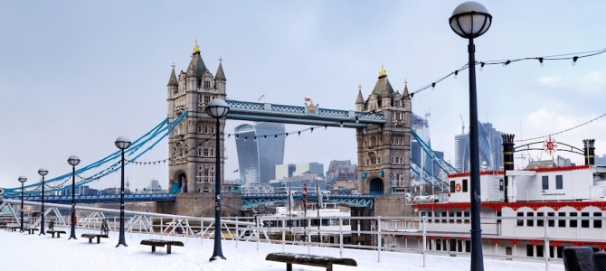
Just four weeks ago Londoners woke up to snow covering the city. On Monday, December 12, Londoners have been built snowmen and even had snowball fights at a London Underground station. TfL said 28 bus routes were suspended or curtailed, the M25 was closed in both directions, and 12 National Rail and London Underground lines were badly disrupted.
In the coming days we are looking at daily doses of rain but by Tuesday (January 17), the North of the country will be hit by a snow storm. According to the chart, the weather will periodically scatter snow showers around London.
But on Saturday (January 22), the capital could once again become a winter wonderland as a huge dollop of snow is dropped. The colour-coded map shows a huge band of dark, purple shading - which indicates around once centimetre of snow falling per hour.
While no other forecaster is currently predicting the same white dusting, the BBC have said that temperatures will drop once again.Predicting the coming weekend, the BBC wrote: "Saturday will be cloudy and wet early on, but rain will clear away by the afternoon to reveal sunny spells. A windy day. Sunday looks to be a windy and colder day.
"It will remain largely dry with variable cloud and sunny spells. Dry conditions will continue for most on Monday, with long bright spells in the morning but turning cloudy in the afternoon. Turning colder."
MyLondon
Rośnie presja na Pałac Kensington, by opublikować oryginalne zdjęcia księżnej Kate, a nie takie, które zostały zmanipulowane cyfrowo. Manipulacji, jak się...
A passenger plane lost a section of its fuselage in mid-air, forcing it to make an emergency landing in the US state of Oregon on Friday.
London Eye forced to close after being battered by 70mph Storm Henk winds. A family were left terrified as the London Eye was battered by strong winds on Tuesday (January 2).
Setki osób zebrały się w sobotę przed siedzibą BBC w Londynie, protestując przeciw — jak twierdzą — stronniczości publicznej stacji w relacjonowaniu...
Policja wszczęła obławę na podejrzanego o terroryzm Daniela Abeda Khalife’a, który uciekł z więzienia w Wandsworth, podaje BBC. Mężczyzna zbiegł,...